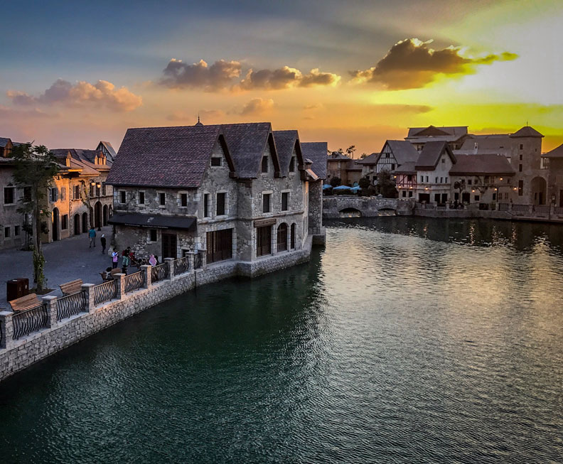
Lagoon Detailed Design for Dubai Parks, United Arab Emirates
The Lagoon is part of the attraction of Dubai Parks Themed Park and has an area of 50,000 sqm (Phase 1).
Scope
- Detailed Engineering Design
- Lagoon Modelling
- Construction Supervision
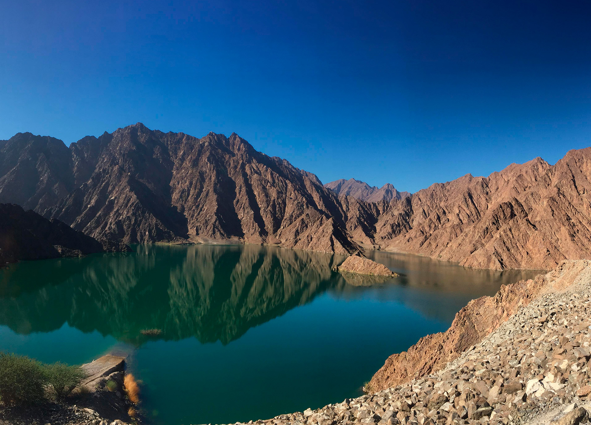
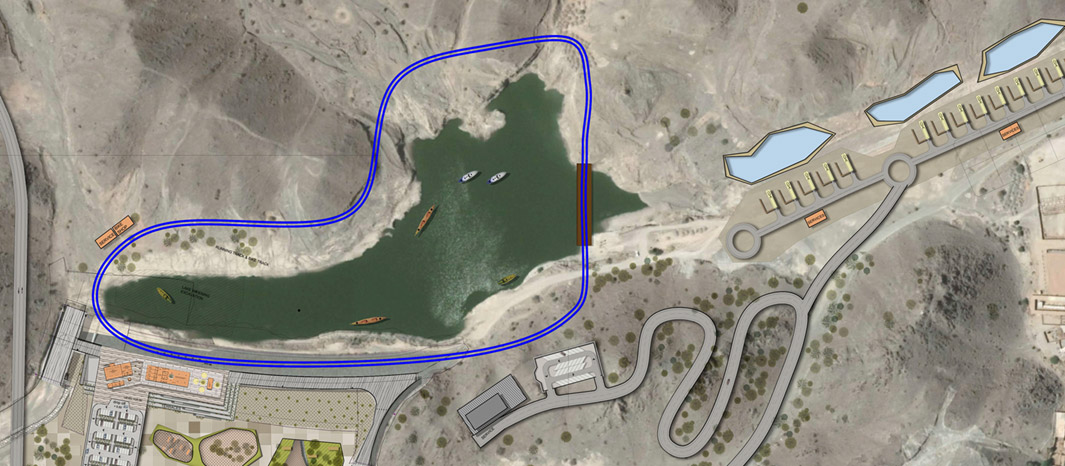
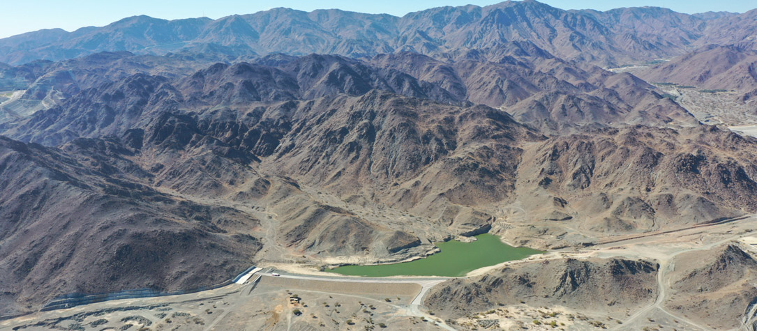
Assessment Study for the Developing and Maintaining the Existing Water Bodies in Hatta-Dubai
Evaluation of sustainability of dams and reservoirs and their compatibility with touristic Infrastructure Development, Agricultural development and domestic and industrial water supply. Effect of climate change on the reservoir level and simulation of various scenarios of the impact of climate change on the capacity of the reservoirs. Assessment of the hydrological regime in the Hatta Watershed including the sub-basins. Delineation of the watershed and the definition of the sub-basins
Scope:
- Recommend water management measures to enhance the sustainability of the reservoirs and water bodies and their water quality.
- Preparation of an Integrated Water Resources Management guidelines and Framework for the Watershed.
- Preparation of pre-conceptual Engineering designs for structural measures as well as non-structural corrective measures to sustain the water levels during dry years.
Ras Al Khaimah - Dams & Barriers
The project mandate is to update the studies of the dams and barriers located in the Emirate of Ras Al Khaimah, covering an area of approximately 1,000 km2. The scope of the project includes the design and construction of hydraulic structures to protect the developed areas as well as to harvest and stores rain water to hold it from flowing to the sea.
Scope:
- Hydrological and Hydraulic Modelling
- Preparation of Designs
- Preparation and Issue of Tender / Contract Documents
- Construction Supervision
Northern Emirates Dams, United Arab Emirates
The Northern UAE Cities and towns tend to be developed downstream of the Wadis to make use of the flat, fertile ground. However, due to their location, these areas are also prone to flooding. CHSS is responsible for study, design and construction management of structures for flood management.
Scope
- Update Previous Studies and Designs (13 No Basins)
- Recommend New Dam Locations - If Required
- Preparation of Designs (Selected Locations)
- Preparation and Issue of Tender / Contract Documents
- Construction Supervision
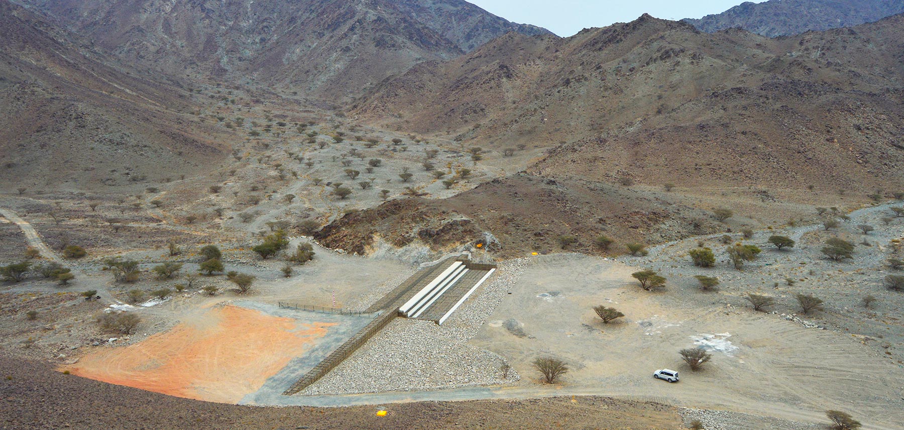
Detailed Design and Construction Supervision of The Dams and Barriers in Sekamkam, Fujairah, United Arab Emirates
The project includes the design and construction of 2 dams, 4 breakers, and 1 retention pond located in Sekamkam, Fujairah.
The structures were proposed as flood mitigation measures for the area of Sekamkam as well as to retain water in order to recharge the aquifer for agriculture use.
Scope
- Feasibility Study
- Preliminary and Detailed Dams Engineering Design
- Tender Services
- Construction Supervision
Tinggi - Detail Design Of River Protection Works And Landscaping Along Sungai Johor
The project entailed the detail designs for bank protection works, recreational facilities and landscaping works for Sungai Johor at Kota Tinggi for a stretch of 1.2km on both banks of the river.
Scope:
- Investigation and analysis for the cause of river bank erosion of the effected areas
- Formulate conceptual designs of river bank protections works deemed necessary to mitigate erosion problem
- Detailed design of river bank protection works
- Detailed design of all outlet structures and associated works
- Detailed design of landscaping works and recreational facilities

Lemal & Rantau Panjang Flood Protection Scheme
For the Lemal area, this project involved the construction of a dyke measuring 1 km away in parallel to the Golok river. For the Rantau Panjang area, the existing Lubok Stol-Rantau-Lanchang State road was upgrade to a flood protection bund to protect the agricultural areas and the surrounding towns. Necessary drainage were also provided for these areas. The increase in water levels in Golok river was reduced to pre-works level via a construction a 500m in width by pass channel and bridge.
Scope:
- Flood Mitigation Studies involving Hydrology and Hydraulic Analyses
- Mathematical Modelling of Flood in the Golok river basin
- Detailed Design of Floodway, River Improvement and Flood corridor
- Detailed Design of River bunds, River Walls and Bank Protection
- Geotechnical Investigation and design
- Sociological Studies
- Formulation of Land Acquisition and Resettlement Plans
- Design of Road Network and Pavements
- Environmental Impact Assessment
- Formulation of Agricultural Development Plan
- Economic Evaluation of Project Options